Live conditions, the best day-float sections by mile marker, Dillard Mill and Red Bluff, the outfitter directory, the shared Steelville gauge, and a built-in trip planner — your complete guide to floating Huzzah Creek.
Length
33 mi
Difficulty
Class I
Region
Ozarks
Season
Apr–Jun
Type
Rain-fed creek
Typical distance
5–8 mi day floats
Best for beginners
Highway Z → Huzzah Valley (~7 mi)
Primary gauge
Steelville · USGS 07017200
Recommended outfitter
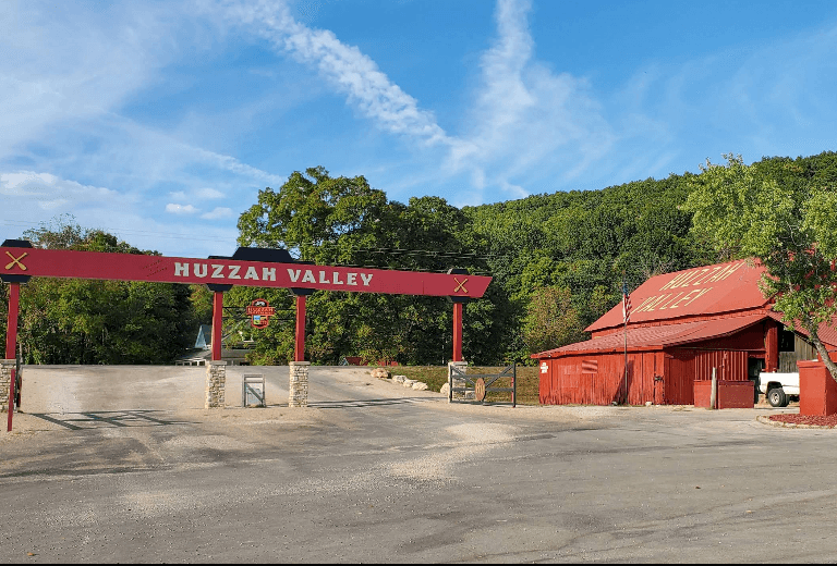
Huzzah Valley Resort
Live conditions
Today on the Huzzah Creek
Eddy reads the gauge, the trend, and the forecast and writes a fresh take a few times a day. Use it as one input alongside your own judgment, the outfitter you’re renting from, and the most recent NPS advisories.
The pitch
Why the Huzzah Creek is different
Huzzah Creek is the easy Steelville day float. A clear, gravel-bottomed tributary of the Meramec, it runs short, shallow, and friendly — the kind of creek you can float in an afternoon and pair with the Courtois for a full weekend. It's rain-fed, so it drops fast in summer and spikes after storms; the upper creek above Red Bluff is usually only floatable in spring. (Pronounced 'HOO-zaw.')
A true day float. Short sections of 5–8 miles mean you can run the whole thing in an afternoon — no logistics-heavy shuttles or overnights required.
Hub
Steelville
Clear, shallow, and intimate. Smaller and more intimate than the Meramec it feeds, with bright gravel bars made for swimming. Go light — kayaks and canoes beat rafts here.
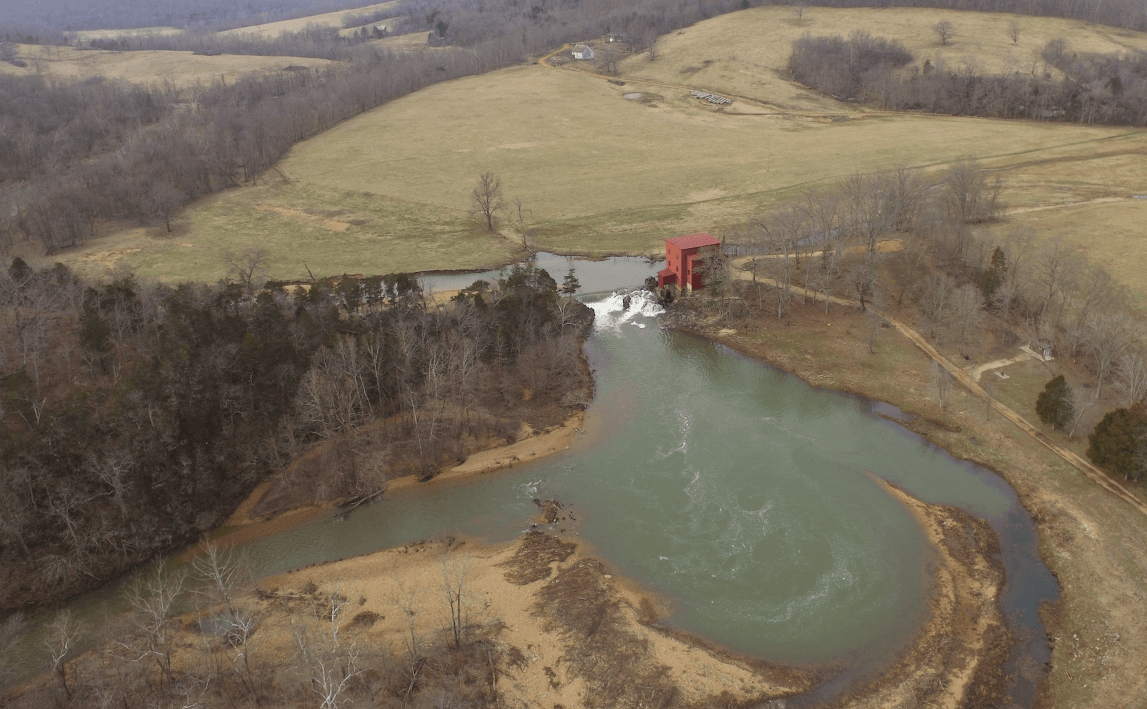
History at the put-in. The float starts at Dillard Mill, one of Missouri's best-preserved water-powered gristmills — a red mill run as a State Historic Site.
Pairs with the Courtois. Same Steelville hub, same watershed. Float one creek Saturday and the other Sunday — just remember they share a gauge.
Float sections
Pick your float
The Huzzah Creekdivides cleanly into character zones. Pick by how much time you have, who you’re paddling with, and what you want to see.
Segment · upper
Upper Huzzah — Dillard Mill to Red Bluff
Small, clear, and floatable mainly in spring or after rain. It starts at the historic red Dillard Mill and runs scrapy in summer — best caught early in the season.
The headwater run, starting at the historic red Dillard Mill (mile 0.1). Small, clear, and pretty down to the Red Bluff Recreation Area (mile 8.3) — but it usually needs spring runoff or a recent rain to float cleanly. Scrapy by mid-summer.
Best for: Spring paddlers, history, scenery
Segment · lower
Lower Huzzah — Red Bluff to the Meramec
The popular outfitted creek below Red Bluff: easy Class I day floats past Huzzah Valley Resort down toward the Meramec. Shallow and clear, best in a kayak or canoe.
Below the towering Red Bluff the creek opens into the popular mid-creek float, with clear water and gravel bars down to the Highway Z bridge (mile 16.3). A reliable half-day when the gauge has water.
One of Missouri's best-preserved water-powered gristmills — a red mill on Huzzah Creek run as a State Historic Site, with tours in season. The headwater put-in.
mile 8.3
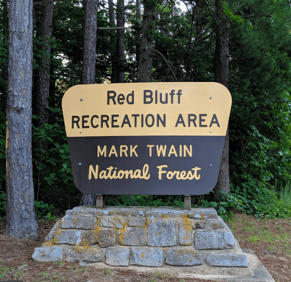
Red Bluff
A tall red dolomite bluff over a USFS recreation area and campground — the creek's signature landmark and a favorite swimming hole.
mile 28.4
Huzzah Conservation Area
An MDC conservation area along the lower creek near the Meramec, with gravel-bar access and primitive camping.
Directory
Outfitters, campgrounds & lodging
Every active service that operates on the Huzzah Creek. Tap a phone number to call; tap Reserve to book.
USGS data
Water levels & gauge
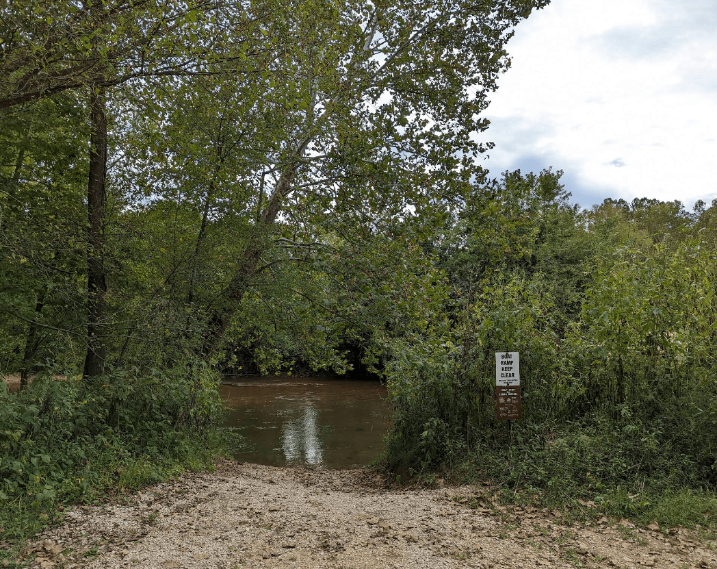
Check the gauge before you load the truck. The trend over the last week matters more than today’s number — a falling river after a flood is fine; a rising river isn’t.
Park rules
Regulations
Mixed management
Dillard Mill (State Historic Site), Red Bluff (USFS Mark Twain National Forest), and the Huzzah Conservation Area (MDC) each set their own rules. Check the signage at your put-in.
Glass is discouraged on Missouri streams, and the Huzzah is small and heavily used near Steelville on summer weekends. Carry out everything you bring in.
PFDs (legally required — one per person, worn by anyone under 7).
Dry bag for keys, phone, and ID.
Drinking water — there's no potable water on the creek.
Reef-safe sunscreen and a hat.
Hard-soled water shoes — the creek is shallow and rocky, with lots of in-and-out.
A light boat — kayak or canoe over a raft on this small water.
Trash bag — pack out everything; it's a small, heavily used creek.
Plan
It's a creek — check the gauge first. Huzzah drops fast in a dry spell and spikes after rain. Below about 2.0 ft at the Steelville gauge (USGS 07017200) you'll be dragging, especially up top.
Upper creek is spring-only. Dillard Mill to Red Bluff usually needs spring runoff or a recent rain. By summer, float the lower creek near Huzzah Valley instead.
Pair it with the Courtois. Same Steelville hub and watershed — float one Saturday and the other Sunday. But they share a gauge: when the Huzzah is low, the Courtois is too.
Go light. The Huzzah is shallow; kayaks and canoes track better than rafts and you'll drag less.
Safety first: Eddy is a planning guide only. Always consult local outfitters and authorities for current conditions before floating. Water levels can change rapidly. Wear life jackets and never float alone.
Crowd
Busy summers
The outfitter stretch around Huzzah Valley Resort (mile 23) — the busiest, most beginner-friendly water on the creek, with rentals and shuttles right on the bank. Reserve ahead on summer weekends.
Best for: Families, day-trippers
Crowd
Moderate
The lower run down to the Huzzah Conservation Area (mile 28.4), an MDC tract near the creek's mouth at the Meramec. Quieter water, primitive gravel-bar camping, and a relaxed end to the day.
Family-run resort since 1979, located on Huzzah Creek east of Steelville. Offers 2.5 miles of riverfront camping, canoe/kayak/raft rentals, cabins, restaurant, and shuttle service. Serves Huzzah Creek, Courtois Creek, and Meramec River.
Primary Meramec River outfitter with 1 mile of riverfront near Leasburg. Canoe, kayak, raft, and tube rentals with shuttle service. Also offers camping, cabins, and services for Huzzah Creek floaters.
Full-service outfitter on Courtois Creek, also serving Huzzah Creek and Meramec River. Family-run for 50+ years. Canoe/kayak/raft rentals, shuttle service, camping, cabins, and horseback riding.
State historic site on upper Huzzah Creek featuring a beautifully restored 1908 red gristmill. Uppermost access point for Huzzah Creek. Picnic area and hiking trail.
USFS campground in the Mark Twain National Forest on Huzzah Creek. Four camping loops with mix of electric and primitive sites. Named for towering red bluffs carved over thousands of years.
Tent Camping
Cabins & lodges
2
RiverHills Retreats
Steelville, MO
8 retreat properties near Steelville accommodating up to 160 guests total. Select properties have RV hookups.