← Back to Blog·June 17, 2026·11 min readRiver Guides
Eleven Point River · National Wild & Scenic River

Eleven Point River
Float Trip Guide.

Live conditions, the best float sections by mile marker, Greer Spring, the USFS float camps, the outfitter directory, and a built-in trip planner — your complete guide to floating Missouri's wildest Wild & Scenic river.

Eleven Point River hero
W&S length
44 mi
Difficulty
Class I–II
Region
Ozarks
Season
Jun–Sep
Manager
USFS
Big spring
Greer (MO #2)
Typical distance
5–19 mi day floats; multi-day to 44 mi
Best for beginners
Greer → Turner Mill (5 mi, 2–3 hr)
Primary gauge
Bardley · USGS 07071500
Recommended outfitter
Richards Canoe Rental
Live conditions

Today on the Eleven Point

Eddy reads the gauge, the trend, and the forecast and writes a fresh take a few times a day. Use it as one input alongside your own judgment, the outfitter you’re renting from, and the most recent NPS advisories.

The pitch

Why the Eleven Point is different

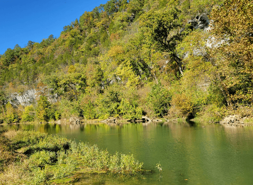
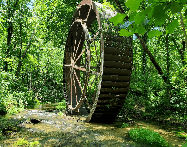
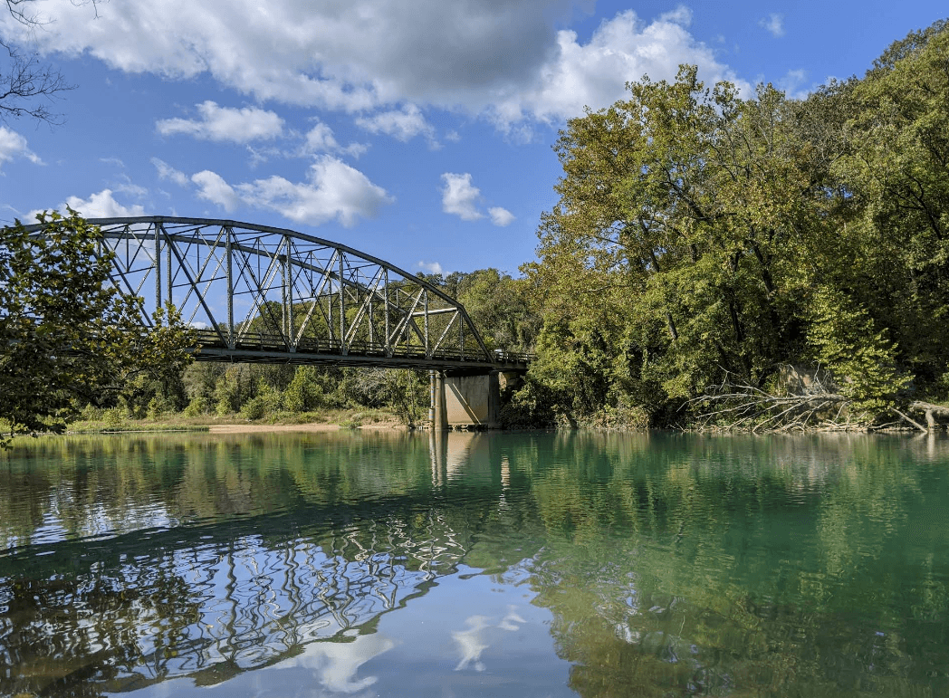
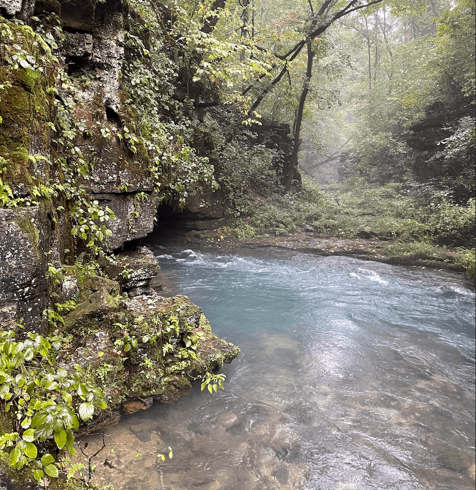
The Eleven Point is the actual Wild & Scenic River. One of the original eight streams Congress designated in 1968, it runs remote and uncrowded through the Mark Twain National Forest, managed by the U.S. Forest Service. Greer Spring — Missouri's 2nd-largest spring at roughly 222 million gallons a day — doubles the river at its midpoint, turning a small Ozark headwater into cold, clear, reliable float water. (Its sister the Current, despite the name, is not on the Wild & Scenic list.)

  • Genuinely Wild & Scenic. A federally designated Wild & Scenic River since 1968, USFS-managed, with first-come float camps instead of crowds. This is the most wilderness-feeling float of Missouri's well-known rivers.
  • Greer Spring changes everything. Above Greer the river is a small, rain-dependent headwater. Below it — fed by ~222 million gallons a day — the Eleven Point roughly doubles and runs cold and clear right through summer.
  • Remote, with few bailouts. Far fewer outfitters and access points than the Current. Long stretches with no road, no cell service, and no help nearby. Plan your shuttle and your water.
  • Wildlife you'll actually see. You may spot bald eagles, great blue herons, and river otters along some of the least-developed water in the state.
Float sections

Pick your float

The Eleven Point divides cleanly into character zones. Pick by how much time you have, who you’re paddling with, and what you want to see.

Segment · upper

Upper Eleven Point — Thomasville to Greer

Small, intimate, and dependent on rain or snowmelt. The river above Greer Spring is a narrow Ozark headwater that can be bony by mid-summer — lovely when it has water, a drag when it doesn't.

Thomasville → Greer
1

Thomasville Greer

Open this float in the planner →

The upper river

Distance
16 mi
Float time
Long day
Class
I–II
Crowd
Quiet

The intimate headwaters. From Thomasville (mile 0.1) the river is small and twisty past Cane Bluff (mile 9.3) down to the Greer access (mile 16.6). It needs rain or snowmelt to float cleanly and can be bony in summer — lovely when it has water, a drag when it doesn't.

Best for: Solitude, anglers, high-water paddlers
Segment · lower

Lower Eleven Point — Greer Spring to The Narrows

Below Greer Spring's ~222 million gallons a day the river roughly doubles — cold, clear, and reliable through summer. This is the Wild & Scenic heart: mill ruins, blue springs, first-come float camps, and some of the wildest water in the state.

Greer → Turner Mill
2

Greer Turner Mill

Open this float in the planner →

The Greer Spring run

Distance
5 mi
Float time
2–3 hr
Class
I
Crowd
Moderate

The river transforms. About a mile below the Greer access the Greer Spring Branch pours in and roughly doubles the flow — cold, clear, and fast. Drift down to Turner Mill (mile 21.5), where a large iron mill wheel still stands on river-right above a small spring.

Best for: Half-day floats, first-timers below Greer
Turner Mill → Riverton
3

Turner Mill Riverton

Open this float in the planner →

The float-camp run

Distance
14 mi
Float time
Full day or overnight
Class
I
Crowd
Moderate

The heart of the Wild & Scenic stretch. Pass Whitten (mile 28), the Whites Creek float camp (mile 28.5), and Boze Mill Spring (mile 33.4) — a blue pool and old mill — down to the Riverton bridge (mile 35.6) at Highway 160. String the first-come USFS float camps together for a quintessential Ozark overnight.

Best for: Overnighters, the classic Eleven Point trip
Riverton → The Narrows
4

Riverton The Narrows

Open this float in the planner →

The quiet finish

Distance
9 mi
Float time
3–4 hr
Class
I
Crowd
Sleepy

Below Riverton the river widens and slows past the Morgan Spring float camp (mile 43.3) to The Narrows at Highway 142 (mile 44.3) — the downstream end of the Wild & Scenic designation. Sleepy, pretty water; the McDowell and Myrtle accesses extend the trip further south.

Best for: Quiet drifts, the last Wild & Scenic miles
Off-river stops

Springs & sights worth stopping for

mile ~17
Greer Spring
Missouri's 2nd-largest spring. It enters through the Greer Spring Branch about a mile below the access and roughly doubles the river — colder, clearer, and faster below the confluence. The spring itself is a 1.1-mile hike down from Highway 19.
mile 21.5
Turner Mill (Turner Spring)
An old mill site on river-right where a large iron overshot wheel still stands, fed by a small spring. A popular stop and float camp.
mile 33.4
Boze Mill Spring
A blue spring pool and the remains of an old mill, a short walk up from the float camp on river-right.
Directory

Outfitters, campgrounds & lodging

Every active service that operates on the Eleven Point. Tap a phone number to call; tap Reserve to book.

Outfitters
2
Hufstedler's Canoe Rental & Campground
Riverton, MO
Seasonal — typically April through October.
Campgrounds
1
Camp River Campground
Alton, MO
Cabins & lodges
2
Eleven Point Cottages
Alton, MO
Briarwood Cabins
Alton, MO
USGS data

Water levels & gauge

Check the gauge before you load the truck. The trend over the last week matters more than today’s number — a falling river after a flood is fine; a rising river isn’t.

Park rules

Regulations

Wild & Scenic designation
One of the original eight National Wild & Scenic Rivers (1968), managed by the USFS Mark Twain National Forest from Thomasville to Highway 142. Keep it wild — pack out everything.
Read the official rule →
Float camps
USFS float camps are first-come, first-served — not reservable. Use established sites, build fires only below the high-water line on gravel bars, and follow current fire restrictions.
Read the official rule →
Greer Spring Branch
The Greer Spring Branch is a day-use natural area — no camping at the spring. The spring is a 1.1-mile hike down from Highway 19.
Read the official rule →
Leave No Trace
Carry out all trash, keep 200 ft from the spring branch and tributaries when camping, and don't cut live wood. There's no trash service on the river.
Read the official rule →
By the season

When to go

Mar–Apr
High and cold.
Partly rain-fed, so spring storms bring fast rises and murky water.
May–Jun
Greening up.
The lower river below Greer is clear and reliable; upper river still has water.
Jun–Sep
Prime season.
Greer Spring keeps the lower river floating when other Ozark streams go low. Reserve shuttles ahead.
Sep–Oct
Quiet and colorful.
Thin crowds, fall color, the best wildlife watching of the year.
Nov–Feb
Floatable below Greer.
Cold, private, and remote — pack like you're winter camping and tell someone your plan.
Getting there

Drive times

St. Louis
~3.5 hr to Greer
Get directions →
Kansas City
~5 hr to Greer
Get directions →
Springfield
~2 hr to Greer
Get directions →
Memphis
~3.5 hr to Greer
Get directions →
Pack & plan

Before you launch & on the water

Pack
  • PFDs (legally required — one per person, worn by anyone under 7).
  • Dry bag for keys, phone, ID, and a fleece — the spring water is cold even in July.
  • More drinking water than you think — a gallon per person per day; springs aren't safe to drink and services are far.
  • A downloaded map. This is remote forest with long no-signal stretches.
  • Reef-safe sunscreen, a hat, and hard-soled water shoes.
  • Extra food and a first-aid kit — help can be hours away.
  • Trash bag — float camps are pack-in, pack-out.
Plan
  • Put in at Greer for reliable water. Below Greer Spring the river roughly doubles and floats all summer; above it can be too low. Greer to Turner Mill or Riverton is the classic.
  • Float camps are first-come. USFS riverside camps (Whites Creek, Greenbriar, Morgan Spring, and more) aren't reservable. Arrive early on summer weekends and have a backup gravel bar in mind.
  • Line up your own shuttle. Far fewer outfitters than the Current. Book a shuttle ahead (Richards Canoe Rental, Hufstedlers) or stage two vehicles.
  • Watch for wildlife. You may spot bald eagles, herons, and river otters — keep a respectful distance and a camera handy.
In the area

Nearby attractions

Natural area
Missouri's 2nd-largest spring, reached by a 1.1-mile hike down from Highway 19 — a worthwhile stop even if you're not floating.
State Park
Missouri's 'Little Grand Canyon' — a collapsed cave system of sheer dolomite walls near Thayer, a short drive south.
Wilderness
A 16,500-acre USFS wilderness on the river's east side — the largest in Missouri's national forest, with backcountry trails.
Quick answers

FAQ

About 2–3 hours for the 5-mile run below Greer Spring — a classic half-day and the easiest introduction to the river.
See also
Current — bigger, spring-fed, and family-friendlyJacks Fork — wild and clear, the ONSR sister
Ready to launch?

Plan your Eleven Point River trip on Eddy

Open the Eleven Point River planner →
Safety first: Eddy is a planning guide only. Always consult local outfitters and authorities for current conditions before floating. Water levels can change rapidly. Wear life jackets and never float alone.